
The Ultimate Guide to Choosing the Right Surveying Instruments in Pakistan


Introduction to Surveying Instruments
Surveying is an essential aspect of construction, engineering, and land development projects. In Pakistan, where diverse landscapes require precise measurements, selecting the right surveying instruments is crucial. This guide will help you navigate the options available, ensuring you make informed choices that enhance your project's success.

Understanding the Basics
Before diving into specific instruments, it's important to understand the basics of surveying. Surveying involves measuring and mapping out the environment to determine the relative positions of points. This can include anything from land plots to construction sites, requiring different tools for different tasks.
Common surveying instruments include theodolites, total stations, GPS devices, and levels. Each of these tools serves a specific purpose and is suited for particular types of projects. Knowing the function of each instrument will help you decide which one is best for your needs.
Theodolites and Total Stations
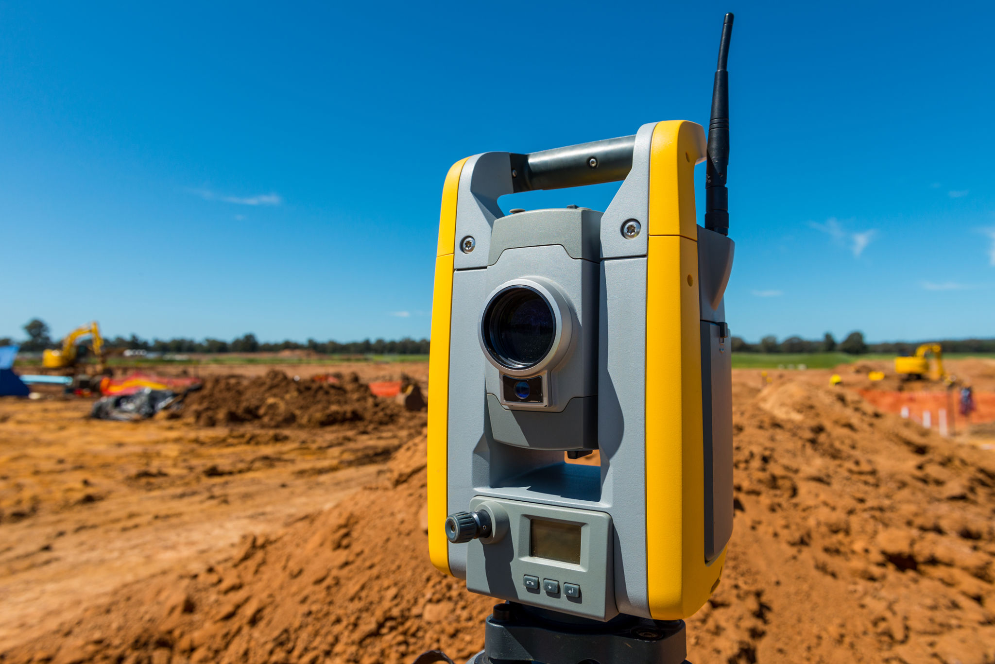
Theodolites are optical instruments used for measuring horizontal and vertical angles. They are vital for tasks requiring precise angle measurements. Total stations, on the other hand, combine electronic distance measurement (EDM) with theodolite functions, providing a comprehensive solution for surveying tasks that require both angle and distance measurements.
When choosing between theodolites and total stations in Pakistan, consider the complexity of your project and whether you need integrated distance measurement capabilities. Total stations offer versatility but might come at a higher cost.
Leveraging GPS Technology
Global Positioning System (GPS) technology has revolutionized surveying by providing accurate positioning data. In Pakistan, GPS devices are especially useful for large-scale projects or in areas where traditional surveying methods might be challenging due to terrain.
While GPS devices offer convenience and precision, they may not be suitable for all projects. Consider factors like signal availability and required accuracy before opting for GPS technology.
Using Levels for Accurate Elevation
Levels are essential for determining elevation differences between points on a site. They are used extensively in construction to ensure that structures are built on level foundations. Automatic levels and digital levels are common options, with digital levels offering enhanced accuracy and ease of use.
When selecting a level in Pakistan, consider the scale and complexity of your project. For simple tasks, an automatic level might suffice, while more complex projects could benefit from the precision of a digital level.

Making the Right Choice
Choosing the right surveying instruments involves assessing your project's specific needs and balancing them with budget constraints. It's crucial to consider factors such as project size, required precision, and environmental conditions.
Engaging with professional suppliers or consulting with experienced surveyors in Pakistan can offer insights into current trends and technological advancements in surveying instruments. This can aid in making an informed decision that aligns with your project's objectives.
Conclusion
In conclusion, selecting the right surveying instruments is a critical step in ensuring the success of any construction or land development project. By understanding the functions and applications of different tools, you can make informed decisions that enhance the accuracy and efficiency of your work.
Whether you're embarking on a small residential project or a large infrastructure development in Pakistan, investing in the right equipment will pay dividends in terms of project quality and longevity.